Tuesday, 1 September 2020

Spatial is Special

Geospatial Information is multidimensional (x,y), oftenprojected onto a flat surface, voluminous, representable atdifferent resolution/scale, with a lot to reveal about us!

Special methods are required to analyse geospatial data Procedures are usually complex and expensive (even if static)

Retrieval of large amounts of data for each analysis (even display), and long transactions for data manipulation requires special database, software, hardware


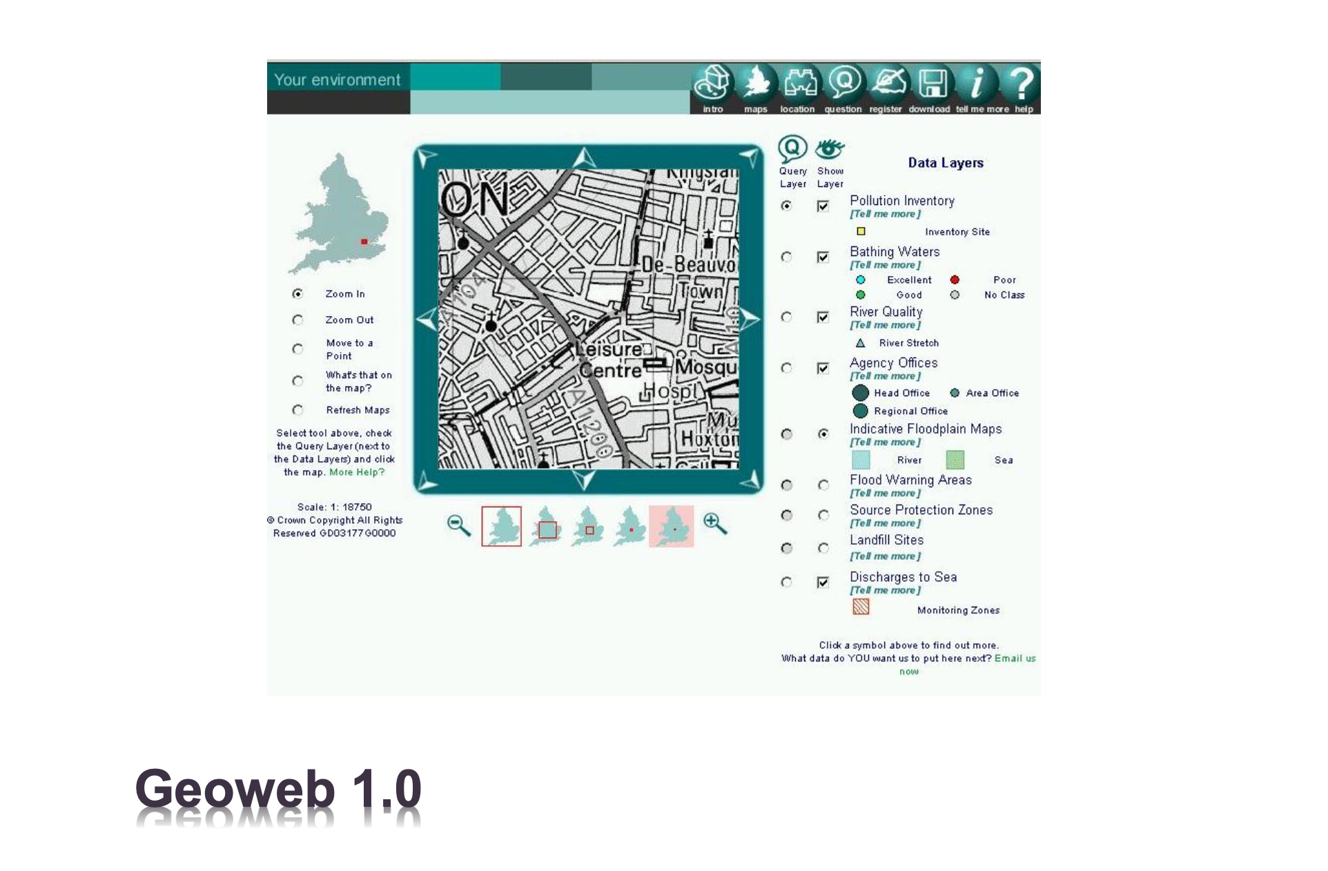


GISystem Can have the following architectures
  1. Desktop GIS
  2. Client Server 
  3. Distributed
  4. Web GIS


Client-Server Architecture (Desktop GIS + Network + Data Server)
  • 3 Logical Layers in many Physical machines 
  • Many clients and one server (data server)
Advantages:
  • Consistency of data (there is only one version of data)
  • Many Users (100 for example; usually below 300 due to limited connection objects)

Distributed Architecture (Desktop GIS + Network + Data Server + Application Server)
  • 3 Logical Layers in many Physical machines
  • Many clients and two servers (application, data server)
Advantages:
  • Consistency of data (there is only one version of data) 
  • Consistency of Analysis
  • Many More Users (1000 for example)
Major Disadvantages of Client-Server and Distributed

• Maintenance of GIS software on client machines
• Limited Number of users: 1m, 10m simultaneous users!!
• Cost: dedicated administrator (team)
• System integration: GIS is not the only system in an organisation

WebGIS
  1. No need to have the GIS software on client machines; just a web browser is needed for clients.
  2. Platform-independency (desktop, mobile, Windows, Mac, Linux,...)
  3. Users with no experience and expertise
  4. Professionals can implement complex what-if scenarios
  5. Low cost (no maintenance, no GIS admin, ...)
  6. Once updated, all clients can access to the latest version of tools and data


Spatial databases Evolution

Why Relational Database is inefficient for geospatial data?
  • Query : Return the shape of (contours) of France?
  • Get all the boundaries of all objects constituting France (Mainland and the islands)
  1. Queries on themes requires a knowledge of the spatial objects’ structure
  2. Changing this structure implies a deep reorganization of the database and changing the query formulation
Why Relational Database is inefficient for geospatial data?
  1. The bad performance of this approach, which requires in particular a considerable amount of relational tuples to represent spatial information
  2. The impossibility of expressing geometric computations such as adjacency test, point query or window query using SQL
page38image20022080


Why Relational Database is inefficient for geospatial data?
  • Queries on themes requires a knowledge of the spatial objects’ structure
  • Changing this structure implies a deep reorganization of the database and changing the query formulation
  • The bad performance of this approach, which requires in particular a considerable amount of relational tuples to represent spatial information
  • The impossibility of expressing geometric computations such as adjacency test, point query or window query using SQL

Geospatial Data Storage (part 1)

1- Geospatial data in text and binary files
  • Text
  • Simple import and export
  • Usually in CSV (Comma Separated Values) format 
  • GeoJSONpage40image20041168

Binary

In most cases they provide little (or no) attribute support 
Limited Support for SRS, complex geometrires
Example: DXF (Autodesk Data eXchange Format)
BSON

Geospatial Data Storage (part 2)
2- Geospatial data in XML files KML, GML and GeoRSS

page41image20028112


Geospatial Data Storage (part 3)

3- Geospatial data in GeoRelational Model (Loosely-Coupled approach)
  • Georelational model is the one of the most widely used models of storage, processing and sharing geospatial data.
  • geospatial data divided into two separate but related structures.
  • The geometrical element of features stored in a binary or set of binary files and corresponding attributes stored in a table (relation in terms of RDBMS).
  • There is a one-to-one relationship between rows in relational database and Features in binary files
Concurrency, security, recovery and ... problems in addition to limited file size and other issues
Geospatial Data Storage (part 4)

4- Use of Spatial Databases
  • 4- A)Native Spatial Database
  • Natively supports spatial data
  • Spatial data-types and functions
  • Integration of functions with query language (SQL)
  • Support of spatial indexing (Accelerating retrieval of data)
Examples: 
PostGIS
SQL Server 
Oracle
DB2
MySQL

page44image20429232


Geospatial Data Storage (part 4)

4- Use of Spatial Databases

4- B)Spatially-Enabled Database
  • Use of relational database to store and manage geospatial data
  • Attributes in columns of normal data-types such as text, int
  • Geometry in BLOB (Binary Large Object)
  • Handle all the geospatial functionality (such as query, analysis, indexing and ...) in Applications
Example:

Esri’s ArcSDE which is a middleware that can use SQL Server, Oracle, Informix, DB2 and PostgreSQL to store and manage geospatial data

Relational database systems to provide data for geospatial services

Advantages:
  • support for geospatial data storage
  • easy to use query language,
  • standard query language (based on OGC simple feature),
  • very good support from developer community,
  • flexibility for modelling various kinds of relationships
  • multiple users,
  • support for transactions (short at DBMS and Long at Application)
Disadvantage:
  • vertical scalability
  • need for multiple joins for complex spatial queries,
  • low performance for large volume of geospatial data

Sunday, 30 August 2020

Study GeoSpatial Data Science!

GeoSpatial Mapping

In simple terms, geospatial information is geography and mapping. It is “place based” or “locational” information. It is data tied to and portrayed on a map. Whether it is MapQuest, Google Maps, or the in-dash navigation system in your car, everyday citizen use geospatial data more than they know it. - sourced by mapp.org

Geospatial Analytics : Geospatial analytics gathers, manipulates and displays geographic information system (GIS) data and imagery including GPS and satellite photographs. They are used to create geographic models and data visualizations for more accurate modeling and predictions of trends.

Application of Geospatial
Geospatial technology refers to equipment used to measure and analyze Earth's land and features. Systems such as Global Positioning System (GPS) and Geographical Information System (GIS) are used in geospatial work. ... GPS can also be used in outdoor recreational activities such as hiking, fishing, kayaking, and boating

Geospatial Technology types
Geospatial technology involves GPS (global positioning systems), GIS (geographical information systems), and RS (remote sensing).

Geospatial technology takes several forms: remote sensing, geographic information systems (GIS), the global positioning system (GPS), geographically referenced land process models, and 3-D landscape visualization.  Remote sensing is an excellent tool for rangeland managers.


Examples of Geospatial Data
Geospatial data, or spatial data (as it's sometimes known), is information that has a geographic aspect to it. In other words, the records in this type of information set have coordinates, an address, city, postal code, or zip code included with them. The most obvious example is a road map.

GeoSpatial data collected
Collection of coordinate information in the field: Coordinate information can be collected in several ways in the field, such as by using a global positioning system (GPS) device or GPS built-in devices, by using high-resolution satellite images, and by address matching/geocoding (conversion of addresses to X, Y .

Difference between spatial and geospatial
As adjectives the difference between geospatial and spatial
is that geospatial is of or pertaining to a geographic location, especially data while spatial is of or pertaining to space.

Geospatial Industry
The geospatial industry comprises of government organizations, private companies, non-profit organizations, and academic and research institutions that develop, manufacture, research and employ geospatial technology.

Geospatial data has been used by law enforcement agencies to predict and prevent crime in several ways: Mapping. Police or other agencies can utilize data from multiple sources and visualize it on layered maps.

Why is Geospatial Data important?
During natural disasters, geospatial data plays an important role in risk management regarding transportation routes. Use of geospatial data informs strategic planners of potential routes that could be impacted due to the risks inherent to geography. These data also help identify evacuations routes.

Methods for Creating Spatial Databases
  1. Manual Digitizing. This is traditionally the most common way to convert paper-based sources of spatial information (e.g. maps) to digital data.
  2. Heads up digitizing.
  3. Coordinate Geometry (COGO) 
  4. Geocoding. 
  5. Global Positioning Systems (GPS) 
  6. Image Processing.
  7. Related GIS Data Resources.
There are many tools that geographers use including maps, which are two-dimensional drawings of the earth, rendered by cartographers; GPS or global positioning system, which uses satellites to locate latitude and longitude and get directions; and GIS or geographic information system, which is a database that collects .

Geographic information systems (GIS) have been used for many years to integrate social and territorial information in quantitative research, but only recently have they been used in qualitative research.

What makes Geospatial Science different? 
What differentiates the discipline from other sciences is that the conclusions include a spatial component. This makes for stronger conclusions and a better understanding of the world, thus allowing decision makers from multiple disciplines to be better informed.

Yes, spatial data is special. Location does matter. Nearby events are more correlated to one another. Spatial data calls for special techniques to tackle autocorrelation problems.

Geospatial analysts examine a range of data from the geographical record including aerial photographs, GIS data, the cartographic record (which includes old maps, new maps, specialist maps such as soil and geology maps), satellite data, soil analysis and other environmental samples, and any academic literature.
Google Earth provides search capabilities and the ability to pan, zoom, rotate, and tilt the view of the Earth.  Google Earth is not a Geographic Information System (GIS) with the extensive analytical capabilities of ArcGIS or MapInfo, but is much easier to use than these software packages

10 Free GIS Data Sources: Best Global Raster and Vector Datasets [2020]
  1. Esri Open Data Hub.
  2. Natural Earth Data.
  3. USGS Earth Explorer.
  4. OpenStreetMap.
  5. NASA's Socioeconomic Data and Applications Center (SEDAC)
  6. Open Topography.
  7. UNEP Environmental Data Explorer.
  8. NASA Earth Observations (NEO)
Types of Geographic Data
  1. Vector Files. Vector data consists of vertices and paths. ...
  2. Raster Files. Raster data is made up of pixels or grid cells. ...
  3. Geographic Database. The purpose of geographic databases is to house vectors and rasters. ...
  4. Web Files. 
  5. Multi-temporal.
Geography is called the mother of science
Responsibilities – Geospatial engineers can be responsible for: Computer-based measuring to map the best position. Producing up to date plans. Setting out a site so that structures are built to scale in the right place. Monitoring the construction process.


Stay tuned!!

Monday, 13 July 2020

What is the relationship between population growth and economic indicators extensively for states of India?'

What is the relationship between population growth and economic indicators extensively for states of India?': The relationship between the population and various economic indicators particularly the Nominal Gross Domestic Produc(GDP) statewise for India. The data was collected and analysed with linear Regression models which resulted in clustering algorithm to get a good silhouette score for Digital Trust and Personal data.In addition to this, the result of the relationship was linear as growth in population and mainly of middle class income group will drive up the consumption which in turn will drive up the economic indices.